Why is this important to you as a resident in this area?
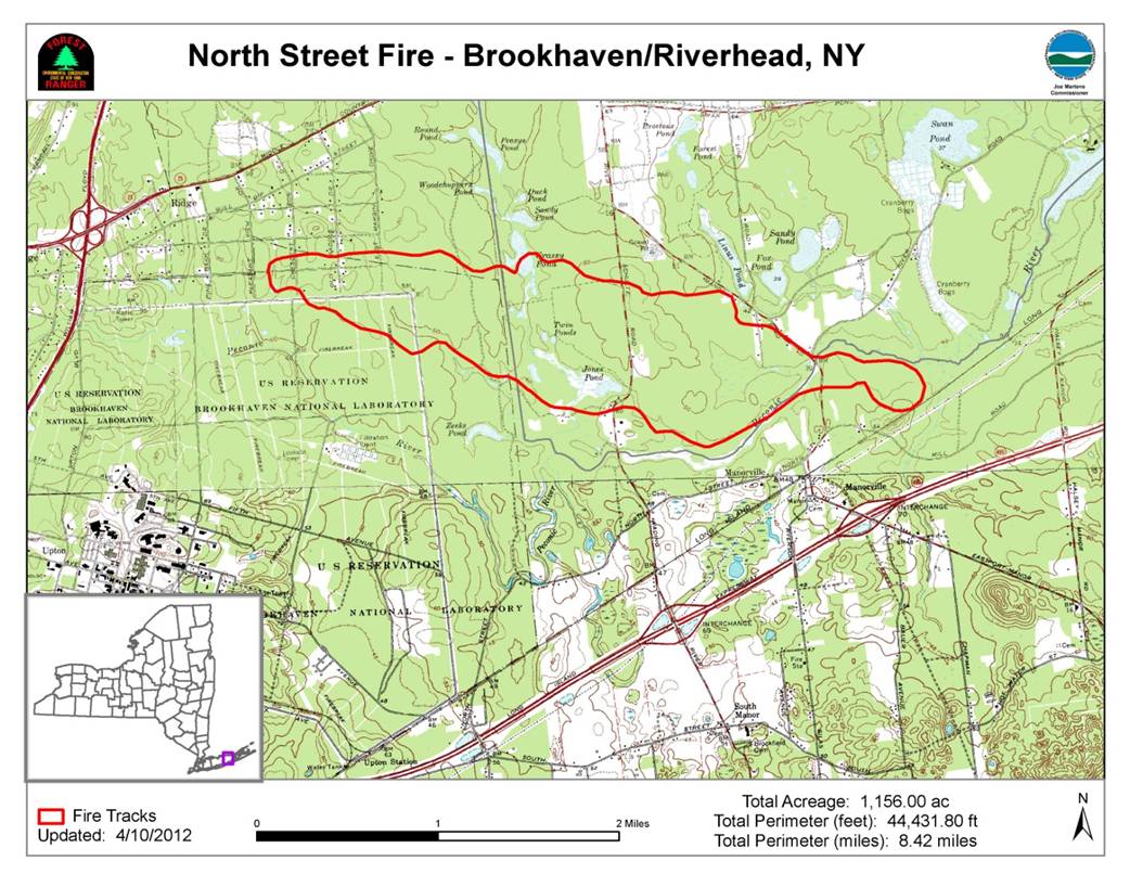
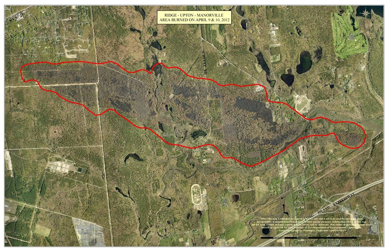
Just three years ago this area was impacted by a wildfire that burned 1,200 acres which greatly impacted the local residents with extensive damage to properties and caused evacuations and road closures. The Central Pine Barrens Commission is working with the Ridge and Manorville Fire Departments and other municipal, state and federal land management agencies to develop a Community Wildfire Protection Plan (called a CWPP) that seeks to identify the most at risk areas of the Ridge, Manorville and Calverton Hamlets to wildfire. The Plan area encompasses the Ridge Hamlet and portions of the Manorville and Calverton Hamlets as indicated in the aerial below. The Plan will identify strategies to mitigate wildfire on the public lands in this area and will also provide an outreach to homeowners on measures that they can readily implement to protect their properties and significantly reduce their loss and damage to their homes from a wildfire through programs such as Firewise and Ready Set Go!, and by learning how to become a Firewise Community. For more information on this project and the CWPP process - Project Information Flyer.

These CWPP stakeholders are seeking input in the planning process from the local residents of Ridge, Manorville and Calverton and ask for you to visit the project Facebook Page to share your thoughts on wildfire, and fill out a brief community survey to help inform the planning process.
Facebook Page - Ridge-Manorville-Calverton CWPP
Residents in the area
- Please complete a brief survey in order for us to capture public perception (from residents of the CWPP planning area) on
wildfire risk and identify public concerns and priorities for mitigation measures.
The survey is linked here Community Wildfire Protection Plan Resident Survey (and is on the Facebook page):
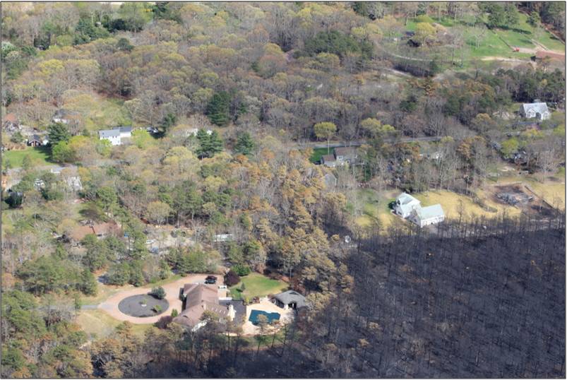
The wildfire came right up to the homes in this area as shown in the photo below. These homes are located in what is called the Wildland Urban Interface which is where the built community is adjacent to woodlands or extensive natural areas as shown below.
AREA POST FIRE - 2 WEEKS

AREA POST FIRE - 9 WEEKS
The Central Pine Barrens area is a fire dependent community which means it contains many species of trees and plants that require fire to make the environment more hospitable for regeneration and growth. Many plants and animals are well adapted to fires and benefit from fire because they have evolved with special traits that enable them to successfully survive fires at various stages in their life cycle. A good example is the Pitch Pine that has serotinous cones that can only open and release its seeds when heated from a fire. The Pitch Pine also has thick fire resistant bark and is capable of basal sprouting and epicormic branching that enables it to survive and thrive after a wildfire. Fire is important to the health of of the Central Pine Barrens; it helps to release nitrogen and other nutrients from woody vegetation back into the soil in the form of mineral-rich ash, which makes them readily available for new plant growth.